Leipzig A walkable City
Leipzig - A City on the Up
Leipzig is a smaller neighbour to Berlin, with a population of about 560,000. Historically, its significance reached far beyond its borders as a major European centre of trade. However, under the East German GDR regime and the fall of the Berlin Wall Leipzig’s population rapidly decreased, leaving a sprawling underpopulated city.
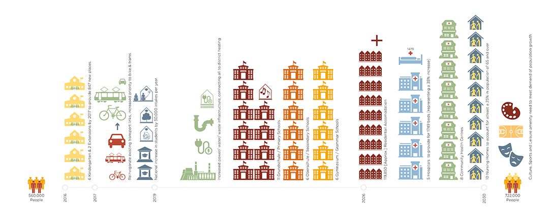
Leipzig is now ‘on the up’, the only city in Germany to have an increasing population. This has come with its own issues as the city authorities lack the infrastructure and services to support the new population. Taking this into consideration, this masterplan developed a ‘shopping list’ of all that the city requires by 2030.
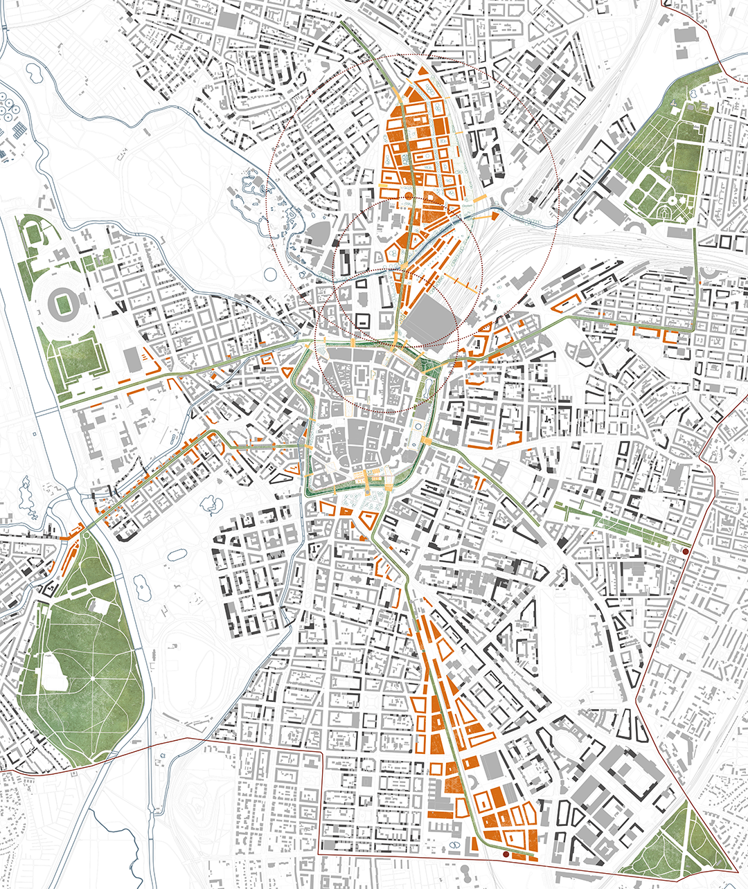
The historic city centre is isolated and surrounded by a large inner city ring road. Removing this impediment formed the starting point of our proposal, removing the inhospitable infrastructure and re-instating the ‘settlement in the linden trees’ with a new urban forest.
A Manifesto for Walkable Cities
We have reached a tipping point, where more people are living in cities than are not. This trend is only set to increase. Therefore, it stands to reason that if we are to achieve a sustainable earth we need sustainable cities.
Cities have sprawled away from their historic centres and into the suburbs. Suburbia caters for the car, leaving communities disparate and disconnected from the services and infrastructure they require. Countering this trend, our Leipzig proposal takes precedent from the walkable communities of the medieval city grid, giving priority to the pedestrian and creating interconnected neighbourhoods.

City Wide Strategy - Prioritising the Pedestrian
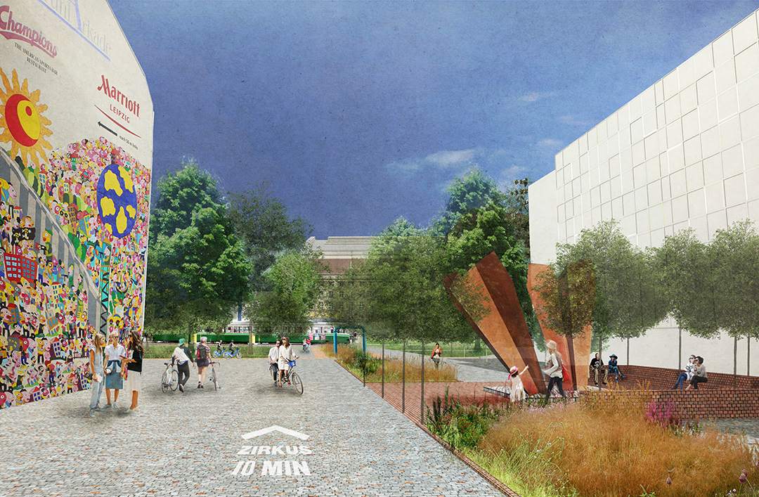
The city wide proposal can be broken in to three elements; re-invigorated ring road around the historic centre, ‘stitching strands’ connecting communities and the redevelopment of two large, derelict train siding sites. The ‘re-invigorated ring road’ becomes a pedestrian focused space, with each ‘stitching strand’ originating from it and becoming new green links containing the distributed items on the ‘shopping list’. The strands are activated by footfall and cyclists with an improved tram network originating from periphery park-and-ride schemes. Installing the new ring road and ‘stitching strands’ provides an opportunity to connect the whole city through one holistic system, with the ring road as a central distribution point for transport, district heating, waste, water and digital infrastructure.
Locale Strategy – The Enfilade Street
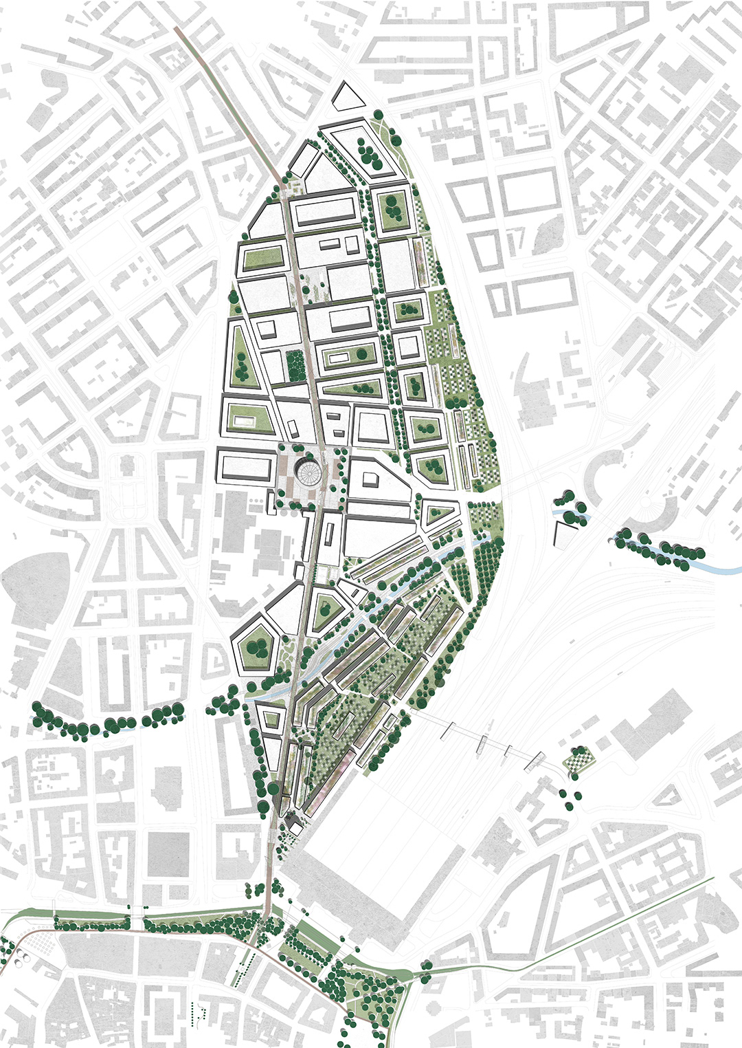
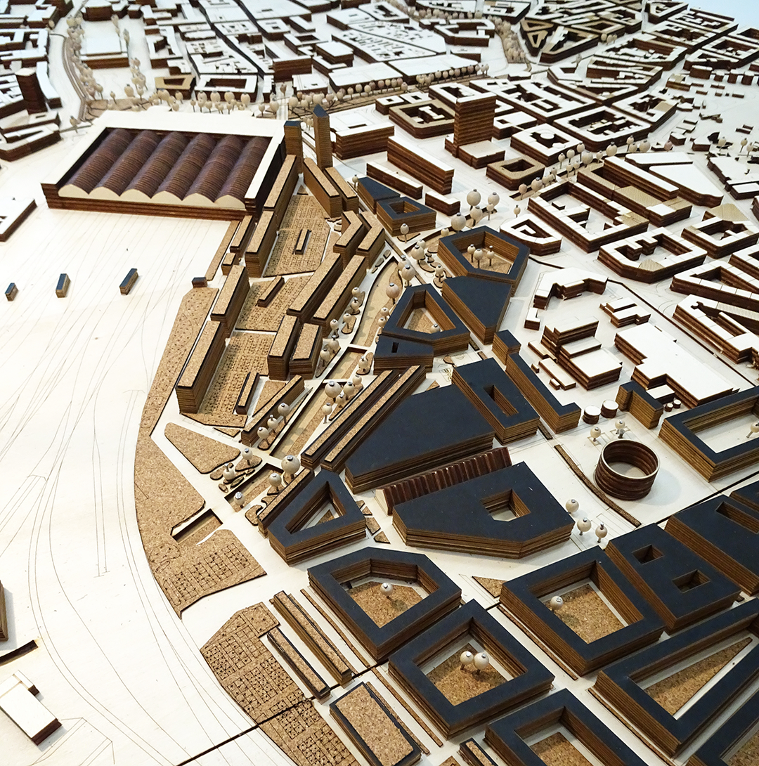
Approximately 553,000m2, the masterplan locale site occupies a disused railway siding to the North of the city centre. The urban design of the locale implemented a walking circle diagram, seen as a prototype for developing the other ‘stitching strands’ identified. This took the form of an enfilade street providing a series of connected public spaces. Each proposed square has its own character, dictated by the public buildings and occur every 2.5 minutes walk. A secondary network of spaces exists alongside the enfilade, drawing reference to the arcade typology of the city centre.
Split by the River Parthe, a commercial zone is proposed in the southern most part of the site, located within a five-minute walking circle of the central train station, utilising its connections to Berlin. The development is taller along the edge next to the train station to allow for more office space and provide a strong gateway into the site. A ‘kleingarten edge’ (allotments) runs along the railway as a buffer zone, reducing noise pollution from the trains.